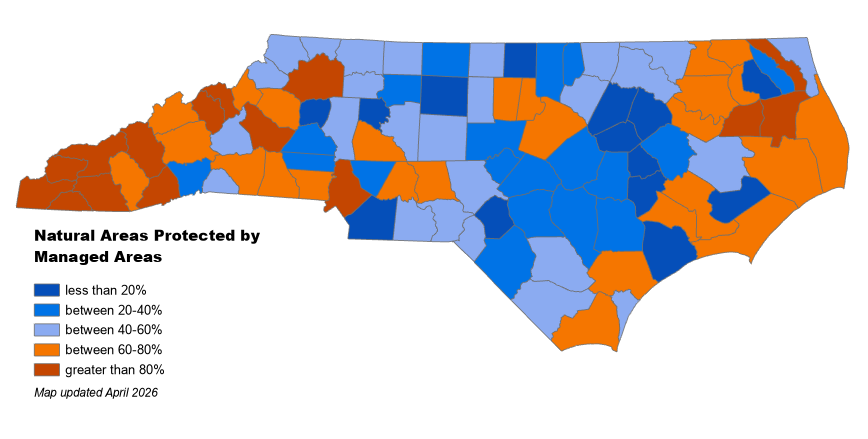
Managed Areas
The Natural Heritage Program maintains GIS data on conservation lands throughout North Carolina. These “Managed Areas” are a diverse collection of properties and easements where conservation of biodiversity and ecosystem function are among the goals of the land management programs.
- Visit our Data Download page for a shapefile of Managed Areas.
- Use our Data Explorer to view Managed Areas on-line.
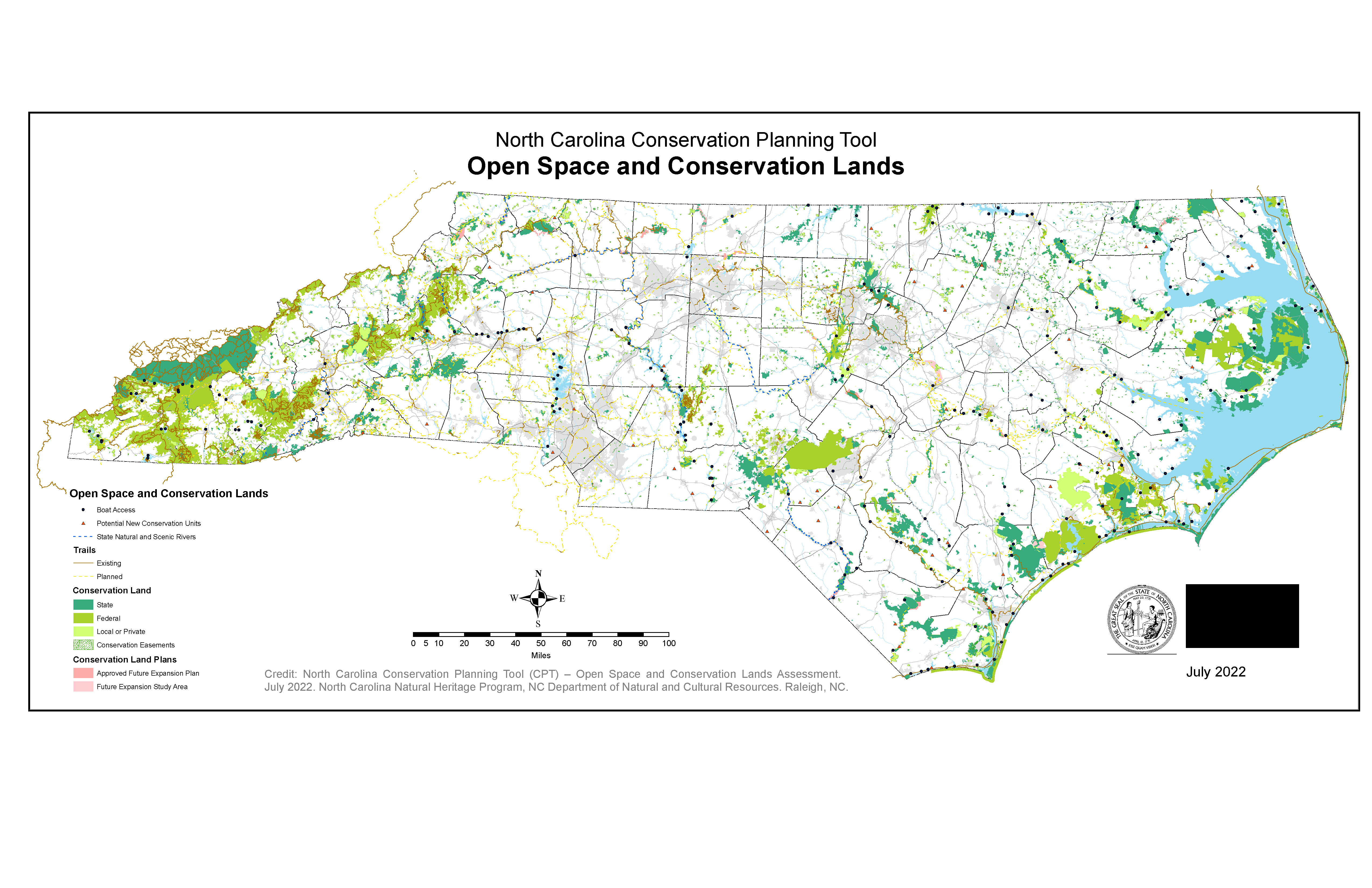
Open Space and Conservation Lands
As part of the Conservation Planning Tool, the Natural Heritage Program produces a map of conservation lands that are in permanent conservation and those that are managed by federal, state, local, and private entities. Instead of valuing and ranking data representing various resources, existing data are simply overlaid into a single map.
- Visit our Data Download page to download the assessment.
- Use our Data Explorer to view the Open Space and Conservation Lands data online.
- Read the Conservation Planning Tool Report to learn more about the Open Space and Conservation Lands dataset and the other components of the Conservation Planning Tool.
Protected Areas Database of the United States
The Natural Heritage Program serves as the state steward for the Protected Areas Database of the United States (PAD-US) and provides data on North Carolina’s protected lands to the U.S. Geological Survey Gap Analysis Program (USGS GAP).
PAD-US is a national geodatabase that represents public land ownership and conservation lands, including privately owned areas, for the continental United States, Alaska, Hawaii, Puerto Rico, the Pacific and US Virgin Islands.